Archive for the 'Destinations' Category
Photo Contest – April 22, 2012
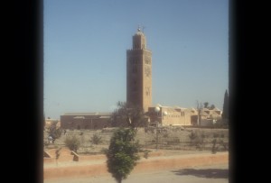
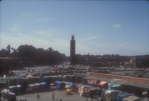
Only 4 people correctly named the structure (shown below) featured in our April 22nd photo contest. It is the Koutoubia. Congratulations to Mark Shapiro of Mission Viejo, CA, whose name was randomly selected from those who responded correctly.
The Koutoubia is the dominating structure in Marrakesh’s Medina (old city) and is the largest mosque in Marrakesh. Rising 221 feet in the air, the 5 times per day call to prayer can be heard throughout the city. The Koutoubia’s minaret was completed nearly a thousand years ago in the 12th century.
The best tomato salad in the world is in Quarzazate, a Moroccan town at the edge of the Sahara dessert. At least, that was our opinion on a visit to Morocco. An order to get to this amazing salad, we had a hair raising bus ride over the Atlas mountains on a twisting, narrow road sans guard rails.
Our “home base” was Marrakesh, one of the most exotic cities that we’ve visited, particularly the Medina where much haggling goes on in the Djemaa el Fna (Place of the Dead). The photo of the square was taken from the café where 14 people died in a terrorist attack in 2011.
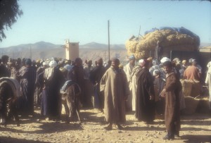
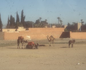
In the new part of Marrakesh, we saw well dressed school children plucking oranges from trees as the made their way home. This contrasted with the Berber markets outside of the city where locals bought and bartered the goods. The Berbers used donkeys to bring their goods to market. The only camels we saw were “tourist camels” used to give rides to visitors.
We can’t say if it’s still there but we had a wonderful dinner cooked in tangines at Mr. Driess’ restaurant in Marrakesh. Despite Rick’s Café, we think that Marrakesh is a far more interesting Moroccan city than Casablanca.
Photo Contest – March 9, 2012
Congratulations to Pat Horne, of Edison, NJ, whose name was randomly selected from the 21 who responded correctly to our March 9th photo contest question.
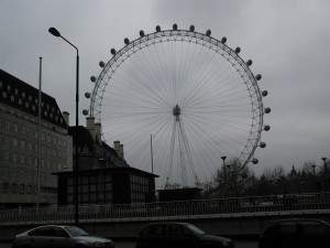
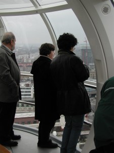
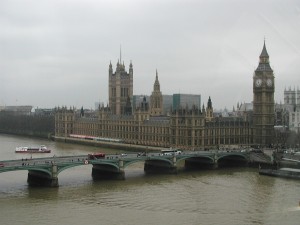
The London Eye, or Millennium Wheel (shown in the contest photo below), was officially called the British Airways London Eye and then the Merlin Entertainments London Eye. In January of 2011, its new official name became the EDF Energy London Eye[following a three-year sponsorship deal. The Eye is located on the south bank of the River Thames in London.
Photo Contest – January 6, 2012
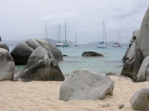
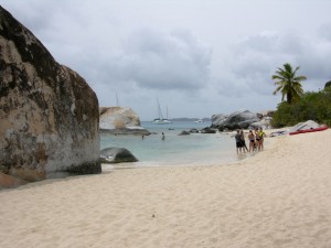
The name of the grouping of boulders shown in our January 6 photo contest (see photo below) is The Baths, which are located on the island of Virgin Gorda, part of the British Virgin Island chain. The winner of the contest, randomly drawn from the 16 people who responded correctly, is Anne Quinn of Lansdale, PA.
The Baths are an amazing collection of exotic pools and grottos formed by giant boulders strewn across sand beaches. Some of the boulders are best appreciated underwater. On more than one snorkeling occaission, we have seen some of the best parrot fish feasting along these underwater havens.
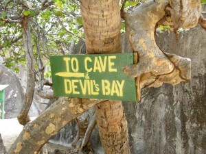
For those who wish to experience the boulders and grottos along an adventurous land/sea route, there is a marked trail to Devil’s bay, which is accessed by cutting through one of the grottos. This path requires a combination of walking, climbing steps, crawling and wading and does require some agility.
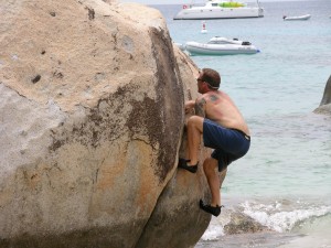
And for those who are most sure-footed and athletic, our rock-climbing friend demonstrated that with the right shoes (he just happened to bring them along) and the right experience, it was possible to reach the peak of one of these boulders.
The Baths are usually offered as an excursion for those cruising to Tortolla, BVI. The Baths also are easy to reach by sailboat (which we have done and can arrange for you).
Photo Contest – December 9, 2011
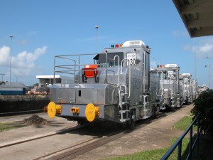
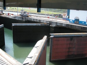
The correct answer for the name of the locomotives in the December 9 photo contest (see photo below) is “mules” and the place is the “Panama Canal.” The winner of the contest, randomly drawn from the 22 people who responded correctly, is Norman Remer of Southamption, PA.
The “mules” guide the ships through the Canal. Today’s ships sometimes have less than two feet of clearance on either side of the ship, so it is critical that the mules keep ships in the center of the canal. Cables are attached to the bow and stern and the mules pull or brake as needed to keep the ships centered. They do not “pull” the ships through the Canal. This is done by the ships’ own power.
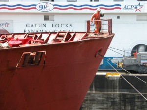
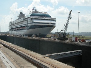
The cables at the bow of the ship are attached to mules which stabelize the ship as it passes through the Canal.
Why are they called “mules”? Mules (the animal) were used to guide ships through many canals, including the one in New Hope, PA. However, electric locomotives were always used on the Panama Canal.
Did you know?
– When you travel from the East Coast to the West Coast, you travel through the Panama Canal in an easterly direction.
– The existing lock chambers are 110 feet wide, 41.2 feet deep and 1000 feet long. Because of clearance issues, the sizes of ships that can pass through are somewhat smaller. The maximum sized ship that can transit the Canal is known as a “Panamax” ship.
– A third set of locks to accommodate much larger ships is underway and is tentatively slated for completion in 2014. These locks are expected to double the capacity of the Panama Canal. The limit on ships sized for this new set of locks is referrred to as ” New Panamax.”
Additional Canal Photos
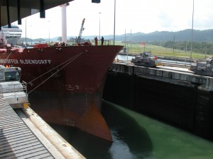
Another view of the ship being stabilized by Mules. Note that the starboard-side cable is taut and the port-side cable is slack.
Photo Contest – October 21, 2011 – Our Visit to Roatan
We thank all of the participants in our photo contest. This is only the second time that we stumped you.
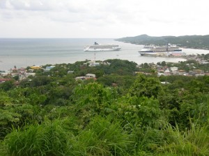
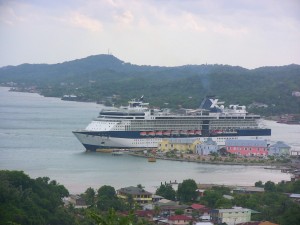
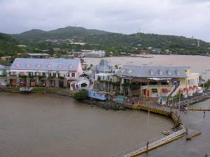
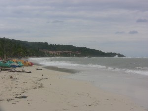
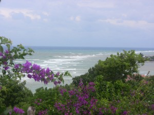
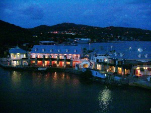
Roatan was one of the very few Caribbean islands that we had never visited and, as certified scuba divers and avid snorkelers, we looked forward to hours of fun in the crystal clear waters for which Roatan is known. Alas, mother nature had other plans for us. One of the worst rain storms in Roatan’s history struck only hours before our arrival aboard Celebrity’s Millennium. Winds were still whipping muddy waves into a dark froth as the ship tied up to the pier in Coxen Hole, the island’s capital.
As soon as we got off the ship, we checked a number of booths offering various excursions. These are nearly always significantly less expensive than the excursions offered by the cruise line. We spent some time comparing the offerings of the local vendors and selected a tour which took us to the key sights of the 36 mile long and 4 mile wide island. Our driver, Francisco, was outstanding and very skilled, which was lucky for us since there were several mud slides and uprooted trees along the hilly and winding roads which are not in good shape in the best weather conditions.
Important: The cruise line guarantees that they will not leave you if you are late getting back from an excursion purchased from the ship. However, you have no such guarantee when you do an excursion on your own or with a local operator. You need to make certain that you know “ship’s time” and that you leave extra time in case your transportation breaks down.
While the overcast skies and wet sand kept bathers off the beaches, it could not hide the beauty that would become stunningly evident once nature reverted to its usual sunny state. The coral reef is not far from the shore and this was our original goal. This reef is the longest in the Western hemisphere and stretches from the tip of the Yucatan down to the Bay Islands (Roatan is one of the Bay Islands and is part of Honduras). The reefs of Riviera Maya, Belize and Cozumel are part of this reef system known as the Mesoamerican reef. The reef is home to over 500 species of fish as well as a large population of manatees.
Many of the best beaches are located on West Bay, a 20 minute taxi ride from the cruise ship. While all of the beaches are public, there’s a catch. In order to get on a beach, you must go through one of the resorts and there is a charge. Bananarama Dive Resort is one resort which will provide round trip transportation from the cruise ship dock and give you access to their facilities for $30 per person . Tabyana is a gorgeous beach which caters to cruise ship passengers and is offered as an excursion by the cruise lines. However, with a bit of effort, you can get to the West Bay beaches by taking a regular taxi to West End, a busy and colorful beach village, and then take a water taxi to West Bay. You won’t pay to get on the beach athough there will be a small charge if you rent beach chairs and umbrella.
During our drive, we saw much poverty which stood in stark contrast to the luxury experienced by most visitors. We learned that most of the economy is controlled by five families and we also discovered that black and white people live in separate communities. Most of the economy is based on tourism although there is a significant fishing industry. Spanish and English are taught in the schools so most folks are bilingual.
Should you visit? If you are a certified scuba diver, this is heaven on earth. Folks who love to soak up the sun on a beautiful beach would be right at home here although there are many other islands which have beaches that are equal to Roatan’s. For our cruise, it was a refreshing change from Jamaica, a usual stop on Western Caribbean cruises.

