Archive for the 'Photos' Category
Photo Contest – January 6, 2012
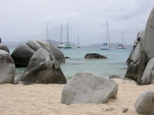
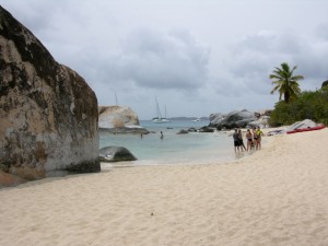
The name of the grouping of boulders shown in our January 6 photo contest (see photo below) is The Baths, which are located on the island of Virgin Gorda, part of the British Virgin Island chain. The winner of the contest, randomly drawn from the 16 people who responded correctly, is Anne Quinn of Lansdale, PA.
The Baths are an amazing collection of exotic pools and grottos formed by giant boulders strewn across sand beaches. Some of the boulders are best appreciated underwater. On more than one snorkeling occaission, we have seen some of the best parrot fish feasting along these underwater havens.
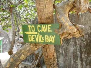
For those who wish to experience the boulders and grottos along an adventurous land/sea route, there is a marked trail to Devil’s bay, which is accessed by cutting through one of the grottos. This path requires a combination of walking, climbing steps, crawling and wading and does require some agility.
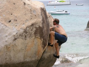
And for those who are most sure-footed and athletic, our rock-climbing friend demonstrated that with the right shoes (he just happened to bring them along) and the right experience, it was possible to reach the peak of one of these boulders.
The Baths are usually offered as an excursion for those cruising to Tortolla, BVI. The Baths also are easy to reach by sailboat (which we have done and can arrange for you).
Photo Contest – December 9, 2011
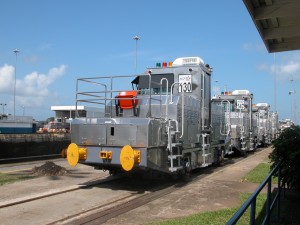
The correct answer for the name of the locomotives in the December 9 photo contest (see photo below) is “mules” and the place is the “Panama Canal.” The winner of the contest, randomly drawn from the 22 people who responded correctly, is Norman Remer of Southamption, PA.
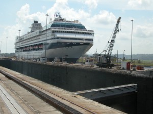
The “mules” guide the ships through the Canal. Today’s ships sometimes have less than two feet of clearance on either side of the ship, so it is critical that the mules keep ships in the center of the canal. Cables are attached to the bow and stern and the mules pull or brake as needed to keep the ships centered. They do not “pull” the ships through the Canal. This is done by the ships’ own power.
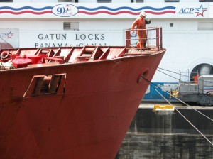
The cables at the bow of the ship are attached to mules which stabelize the ship as it passes through the Canal.
Why are they called “mules”? Mules (the animal) were used to guide ships through many canals, including the one in New Hope, PA. However, electric locomotives were always used on the Panama Canal.
Did you know?
– When you travel from the East Coast to the West Coast, you travel through the Panama Canal in an easterly direction.
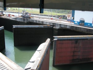
– The existing lock chambers are 110 feet wide, 41.2 feet deep and 1000 feet long. Because of clearance issues, the sizes of ships that can pass through are somewhat smaller. The maximum sized ship that can transit the Canal is known as a “Panamax” ship.
– A third set of locks to accommodate much larger ships is underway and is tentatively slated for completion in 2014. These locks are expected to double the capacity of the Panama Canal. The limit on ships sized for this new set of locks is referrred to as ” New Panamax.”
Additional Canal Photos
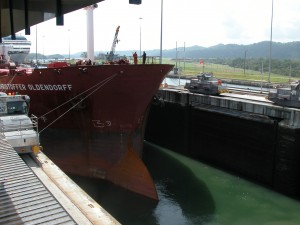
Another view of the ship being stabilized by Mules. Note that the starboard-side cable is taut and the port-side cable is slack.
Photo Contest – November 18, 2011
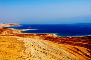
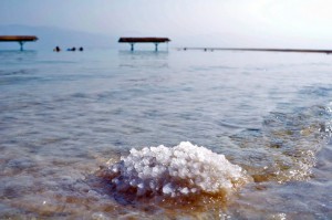
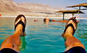
The Dead Sea, also called the “Salt Sea”, is a salt lake bordering Jordan to the east and Israel and the West Bank to the west. It’s geographic claim to fame is that its surface and shores are 1,388 feet below sea level, the lowest elevation on the earth’s surface. However, it is probably most recognized for it’s extreme saltiness. With 33.7% salinity, it is one of the world’s saltiests bodies of water. This salinity makes floating effortless. It also makes for a harsh environment in which animals cannot flourish — hence its name.
Photo Contest – November 4, 2011
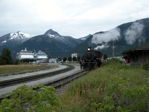
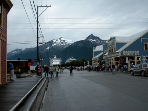
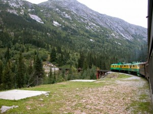
We received 25 responses to our 11/4/11 photo contest and all 25 correctly named the location of our photo (shown below) as Skagway Alaska. The winner of the contest is Chuck Diefenderfer of Maple Glen, PA. Chuck’s name was randomly selected from the 25 who correctly responded.
The town of Skagway has a population of less than 1000 which doubles in size during the summer months to support the influx of tourists. The port is a popular cruise ship stop — understandable when you walk through the small town and, everywhere you turn, there is a breathtaking view of mountains.
Skagway’s White Pass and Yukon Route narrow gauge railroad runs throughout the summer months. It’s locomotive “parks” right in town. We highly recommend this trip which you can purchase as an excursion aboard your ship. Even if you are not a narrow gauge railroad geek (as some of us are), the scenery is amazing.
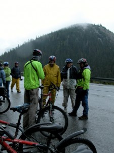
The typical tour offered is round trip. We opted for a tour which took us by train to the top of the mountain and then we biked down. Even with the drizzly weather, the ride to the bottom was exhilarating! There was little pedaling and lots of braking.
Photo Contest – October 21, 2011 – Our Visit to Roatan
We thank all of the participants in our photo contest. This is only the second time that we stumped you.
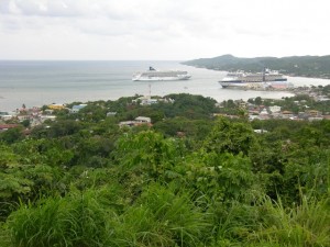
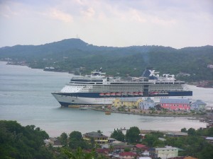
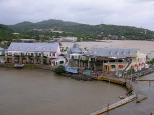
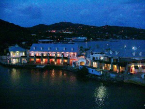
Roatan was one of the very few Caribbean islands that we had never visited and, as certified scuba divers and avid snorkelers, we looked forward to hours of fun in the crystal clear waters for which Roatan is known. Alas, mother nature had other plans for us. One of the worst rain storms in Roatan’s history struck only hours before our arrival aboard Celebrity’s Millennium. Winds were still whipping muddy waves into a dark froth as the ship tied up to the pier in Coxen Hole, the island’s capital.
As soon as we got off the ship, we checked a number of booths offering various excursions. These are nearly always significantly less expensive than the excursions offered by the cruise line. We spent some time comparing the offerings of the local vendors and selected a tour which took us to the key sights of the 36 mile long and 4 mile wide island. Our driver, Francisco, was outstanding and very skilled, which was lucky for us since there were several mud slides and uprooted trees along the hilly and winding roads which are not in good shape in the best weather conditions.
Important: The cruise line guarantees that they will not leave you if you are late getting back from an excursion purchased from the ship. However, you have no such guarantee when you do an excursion on your own or with a local operator. You need to make certain that you know “ship’s time” and that you leave extra time in case your transportation breaks down.
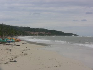
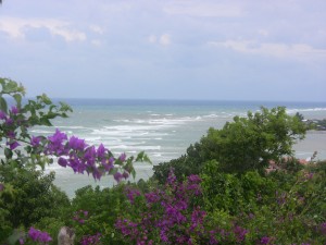
While the overcast skies and wet sand kept bathers off the beaches, it could not hide the beauty that would become stunningly evident once nature reverted to its usual sunny state. The coral reef is not far from the shore and this was our original goal. This reef is the longest in the Western hemisphere and stretches from the tip of the Yucatan down to the Bay Islands (Roatan is one of the Bay Islands and is part of Honduras). The reefs of Riviera Maya, Belize and Cozumel are part of this reef system known as the Mesoamerican reef. The reef is home to over 500 species of fish as well as a large population of manatees.
Many of the best beaches are located on West Bay, a 20 minute taxi ride from the cruise ship. While all of the beaches are public, there’s a catch. In order to get on a beach, you must go through one of the resorts and there is a charge. Bananarama Dive Resort is one resort which will provide round trip transportation from the cruise ship dock and give you access to their facilities for $30 per person . Tabyana is a gorgeous beach which caters to cruise ship passengers and is offered as an excursion by the cruise lines. However, with a bit of effort, you can get to the West Bay beaches by taking a regular taxi to West End, a busy and colorful beach village, and then take a water taxi to West Bay. You won’t pay to get on the beach athough there will be a small charge if you rent beach chairs and umbrella.
During our drive, we saw much poverty which stood in stark contrast to the luxury experienced by most visitors. We learned that most of the economy is controlled by five families and we also discovered that black and white people live in separate communities. Most of the economy is based on tourism although there is a significant fishing industry. Spanish and English are taught in the schools so most folks are bilingual.
Should you visit? If you are a certified scuba diver, this is heaven on earth. Folks who love to soak up the sun on a beautiful beach would be right at home here although there are many other islands which have beaches that are equal to Roatan’s. For our cruise, it was a refreshing change from Jamaica, a usual stop on Western Caribbean cruises.
Photo Contest 10/7/11
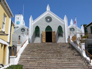
The winner of our 10/7/11 photo contest is Bernie Lineman of Warrington, PA. Bernie’s name was randomly selected from the 11 who correctly identified the contest photo (shown below) as St. Peter’s Church located in St. George, Bermuda.
St. Peter’s is said to be the oldest surviving Anglican chuch located outside of the British Isles. It’s exterier and interior or both lovely in their simplicity. The church is technically located on the Duke of York Street, the main road that passes through St. George, however it sits much higher and further back than its neighbors.
Many Bermuda visitors flock to Hamilton, which is the capital of Bermuda and highlighted for it’s shopping district, but St. George is absolutely worth visiting. It ’s waterfront and back streets are picturesque, walkable and hold a lot of history.
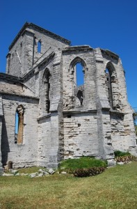
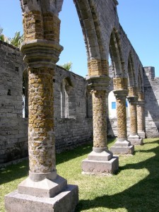
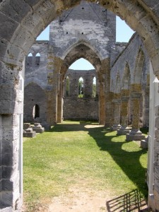
A brief walk from St. Peters is the “unfinished church”, whose construction began in the 1870’s when St. Peter’s Church was badly damaged by a storm and thought to be beyond repair. Once the consctruction was underway, there were funding difficulties and a segment of the local population felt they would rather invest the money in repairing the old church instead of completing the new one.
We were very lucky to capture the photos below during our visit in 2010. In December of 2010, the unfinished chruch was closed to the public due to the potential for crumbling masonry caused by structural deterioration from wind and water.
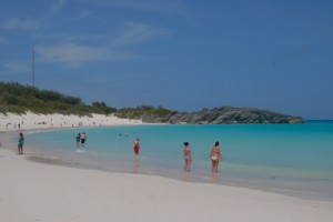
Bermuda is known for it’s beaches. If your ship is docked at the Royal Navel Dockyard located at the western end of Bermuda, you are relatively close to some of Bermuda’s best beaches. Horseshoe Bay is spectacular and has convenient changing facilities and consession stands making it a popular beach choice for visitors.
It’s very easy and economical to go beach hopping either by taking the dedicated beach shuttle or public transportation (be sure to take the bus route along South Road). Bermuda buses are clean and stop at all of the major beaches. The ferry is a terrific and economical way to get from the Dockyard to Hamilton and to St. George. If you have extra time and would like to see some off the beaten track sites, you can also take the bus from town to town.
Photo Contest – September 23, 2011
Photo Contest – September 9, 2011
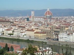
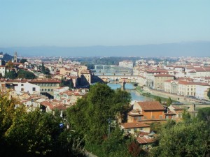
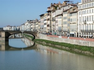
We received over 40 responses to our 9/9/11 photo contest (see photo below). While nearly everyone got the city correct, only 5 responded with the correct answer to the first part of the question, “What is the name of the building?” The winner of the contest is Chuck Greiman of Southampton, PA. Chuck’s name was randomly selected from those who correctly responded.
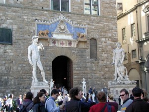
Of course, the city is Florence (Firenze), Italy. The building is the Palazzo Vecchio, Florence’s city/town hall. We accepted “Palazzo Vecchio”, “City Hall” and “Town Hall” as correct answers to this part of the question. Palazzo Vecchio is located in the Piazza della Signoria and it is in front of this building’s entrance that Michelangelo’s David once stood. David was originally commissioned as one of a series of 12 Old Testament sculptures to be positioned along the roofline of the east end of the Basilica of Santa Maria Del Fiore (also known as the Duomo), however once the sculpture was nearing completion, authorities realized the logistical improbability of raising the 6-plus ton statue to the roof of the cathedral. In 1504, after heated debate by a small group Florentine citizens, the statue of David was installed next to the entrance of the town hall, Palazzo Vecchio (known then as “Palazzo della Signoria”).
In 1873, Michelangelo’s David was moved to the Accademia Gallery, allegedly for reasons of conservation, although other factors may have been involved. In addition to David, this gallery houses other works of Michelangelo including some that are unfinished. The history of the artwork housed here is fascinating – it is well worth a visit to this Gallery with a good guide.
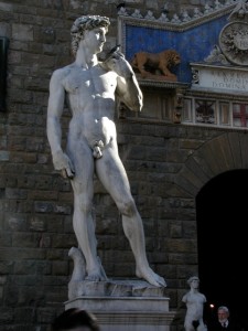
In 1910, a replica of Michelangelo’s David (see close-up below) was placed in the same spot that the original once stood – next to the entrance of the Town Hall.
Behold the muted colors and light of Florence….
Photo Contest – August 26, 2011
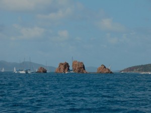
The winner of the 8/26/11 photo contest is Sheila Mandl of North Babylon, NY. Sheila’s name was randomly selected from just 4 who correctly responded to our contest question (what is the name of this grouping of rocks?).
The grouping of rocks in the contest photo (show below) is referred to as “The Indians”, so named for their likeness to an Indian bonnet or headdress when viewed from afar. This series of rocks or rock pinnacles is located just off of Pelican Island in the British Virgin Islands (BVI).
The Indians and Pelican Island are part of a larger complex of islands that lay just across the Francis Drake Channel from Roadtown, the capital of Tortola. Most of the population of the BVIs live on Tortola, a less common but much-appreciated cruise ship port. It is a haven for sailors and a great jumping off point for dive boats, snorkel trips and for excursions to The Baths (Virgin Gorda) because of it’s central location in the BVI chain and it’s proximity to St. John of the US Virgin Islands.
Photo Contest – August 12, 2011
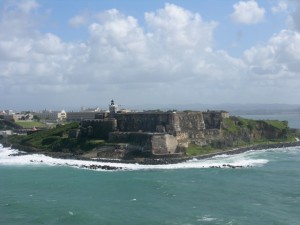
The winner of our photo contest is Bob Mandl of North Babylon, NY. Bob’s name was randomly selected from 29 who correctly responded to our two-part question (name of fort and city that it is located in).
The fort in the contest photo (show below) is commonly known as El Morro and is located in San Juan, Puerto Rico. Castillo San Felipe Del Morro, San Felipe Del Morro Castle and other variations and spellings were also counted as correct answers.
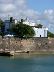
El Morro lies on the northwestern-most point of San Juan. Named in honor or King Phillip II of Spain, the fort was designed to guard the entrance to the San Juan Bay, and defend the city of Old San Juan from seaborne enemies. In 1983, the fort was declared a World Heritage Site by the United Nations.
San Juan
Puerto Rico is 100 miles long and 35 miles wide. Close to 4 million people live on the “Island of Enchantment,” with more than a million of them in the greater San Juan metropolitan area. It is a vibrant, modern, bilingual, multicultural society, one that has been molded by Spanish, African and Native American Tainos with influences from the United States.
Puerto Ricans are U.S. citizens and the United States Congress legislates many aspects of Puerto Rican life. However, the islanders do not vote in U.S. presidential elections. Since 1947, Puerto Ricans have been able to elect their own governor. Its official languages are Spanish and English, with Spanish being the primary language.
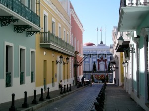
We have spent many days (on a combination of trips) exploring San Juan and most of those days have been focused on the old city where the fort is located. The cobblestone streets and lovely architecture are a photographer’s delight.
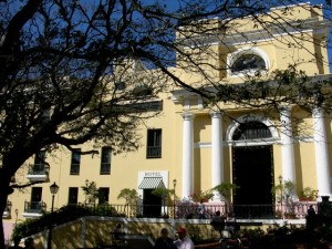
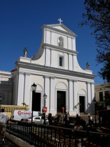
On many evenings, there are free outdoor concerts by the water front (in the old city). In addition to the fort, the old city houses some beautiful churches, the most notable being the Cathedral of San Juan Bautista. While walking through the old city, it is worth visiting El Convento, a converted convent which is now a first-class hotel. While there, take a moment to go up to the 3rd floor for a great view of the city or have a nice cold drink in the courtyard.
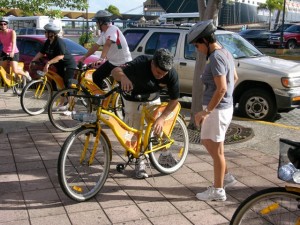
During our last trip to San Juan, we took a bike tour which allowed us to venture beyond the old city into other neighborhoods and visit some “local” sites we might not otherwise have seen.

